1 download limit per item. Licensed for non-commercial, single-use. Re-sale or re-distribution of any kind is prohibited. Intended for personal use on a single device, for additional devices and users, download additional files as needed. Copyright to this file is not transferred to the purchaser and is retained by the licensee.
Halifax Trails makes no warranty, representation or guaranty as to the content, sequence, accuracy or completeness of any of the database information provided herein. The user should not solely rely on the data provided herein. Map information is believed to be accurate but accuracy is not guaranteed. Any errors or omissions should be reported to info@halifaxtrails.ca. In no event will Halifax Trails be liable for any damages that might arise from the use of this mapping service or the information it contains. If you understand and agree to these terms, continue to download.
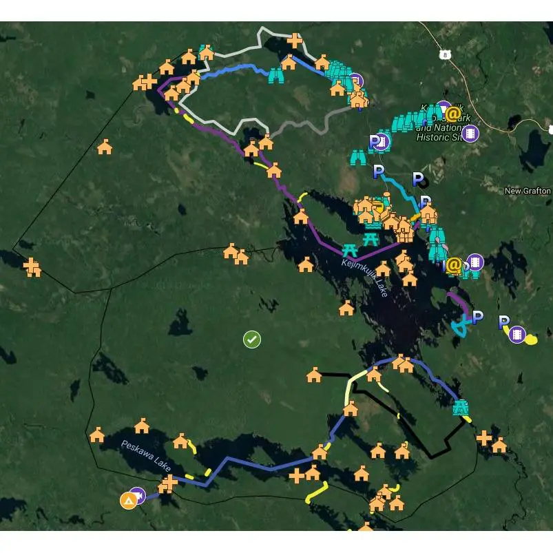
Nova Scotia’s Kejimkujik National Park GPS map. Campsites, hiking trails and more, in .gpx and .kml file formats for GPS devices.
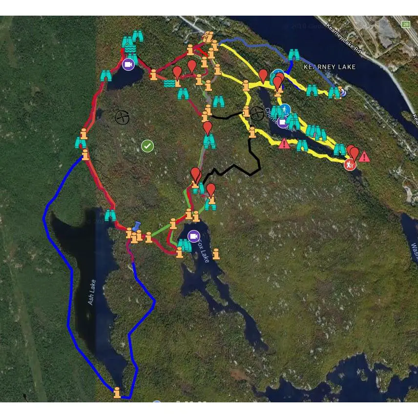
- Includes .gpx and .kml file formats.
- .GPX format works with most GPS devices.
- .KML file is compatible with Google Earth and other common mobile apps.
- Allows navigation without using a cellular network connection.
1 download limit. Licensed for non-commercial, single-use. Re-sale or re-distribution of any kind strictly prohibited. Intended for personal use on a single device, for additional devices and users, download additional files as needed. Copyright to this file not transferred to the purchaser and retained by the licensee.
Halifax Trails makes no warranty, representation or guaranty as to the content, sequence, accuracy or completeness of any of the database information provided herein. The user should not solely rely on the data provided herein. Map information believed to be accurate but accuracy not guaranteed. Any errors or omissions should be reported to info@halifaxtrails.ca. In no event will Halifax Trails be liable for any damages that might arise from the use of this mapping service or the information it contains. If you understand and agree to these terms, continue to download.
1 download limit per item. Licensed for non-commercial, single-use. Re-sale or re-distribution of any kind is prohibited. Intended for personal use on a single device, for additional devices and users, download additional files as needed.
Halifax Trails makes no warranty, representation or guaranty as to the content, sequence, accuracy or completeness of any of the database information provided herein. The user should not solely rely on the data provided herein. Map information is believed to be accurate but accuracy is not guaranteed. Any errors or omissions should be reported to info@halifaxtrails.ca. In no event will Halifax Trails be liable for any damages that might arise from the use of this mapping service or the information it contains. If you understand and agree to these terms, continue to download.
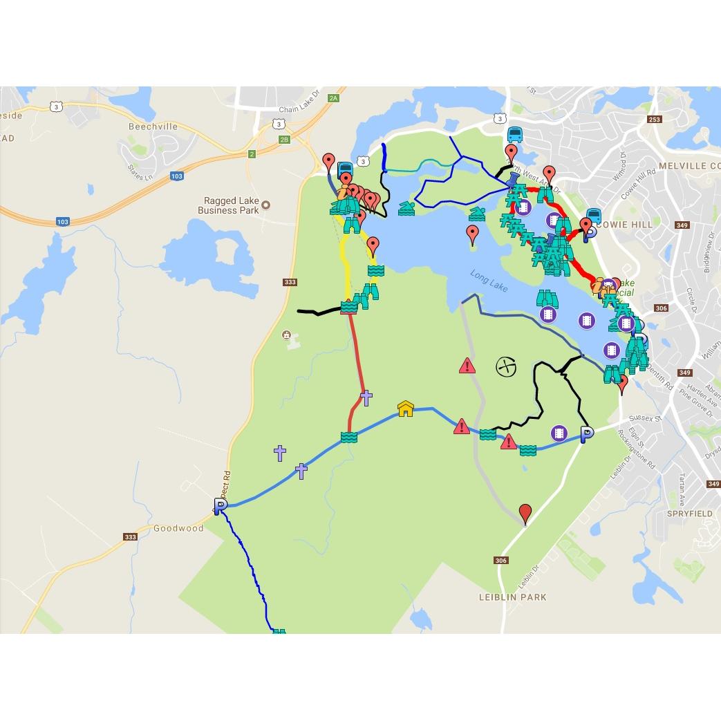
- Includes both .gpx and .kml file formats.
- .GPX format works with most GPS devices.
- .KML file is compatible with Google Earth and other common mobile apps.
- Allows navigation without using a cellular network connection.
1 download limit per item. Licensed for non-commercial, single-use. Re-sale or re-distribution of any kind is prohibited. Intended for personal use on a single device, for additional devices and users, download additional files as needed. Copyright to this file is not transferred to the purchaser and is retained by the licensee.
Halifax Trails makes no warranty, representation or guaranty as to the content, sequence, accuracy or completeness of any of the database information provided herein. The user should not solely rely on the data provided herein. Map information is believed to be accurate but accuracy is not guaranteed. Any errors or omissions should be reported to info@halifaxtrails.ca. In no event will Halifax Trails be liable for any damages that might arise from the use of this mapping service or the information it contains. If you understand and agree to these terms, continue to download.
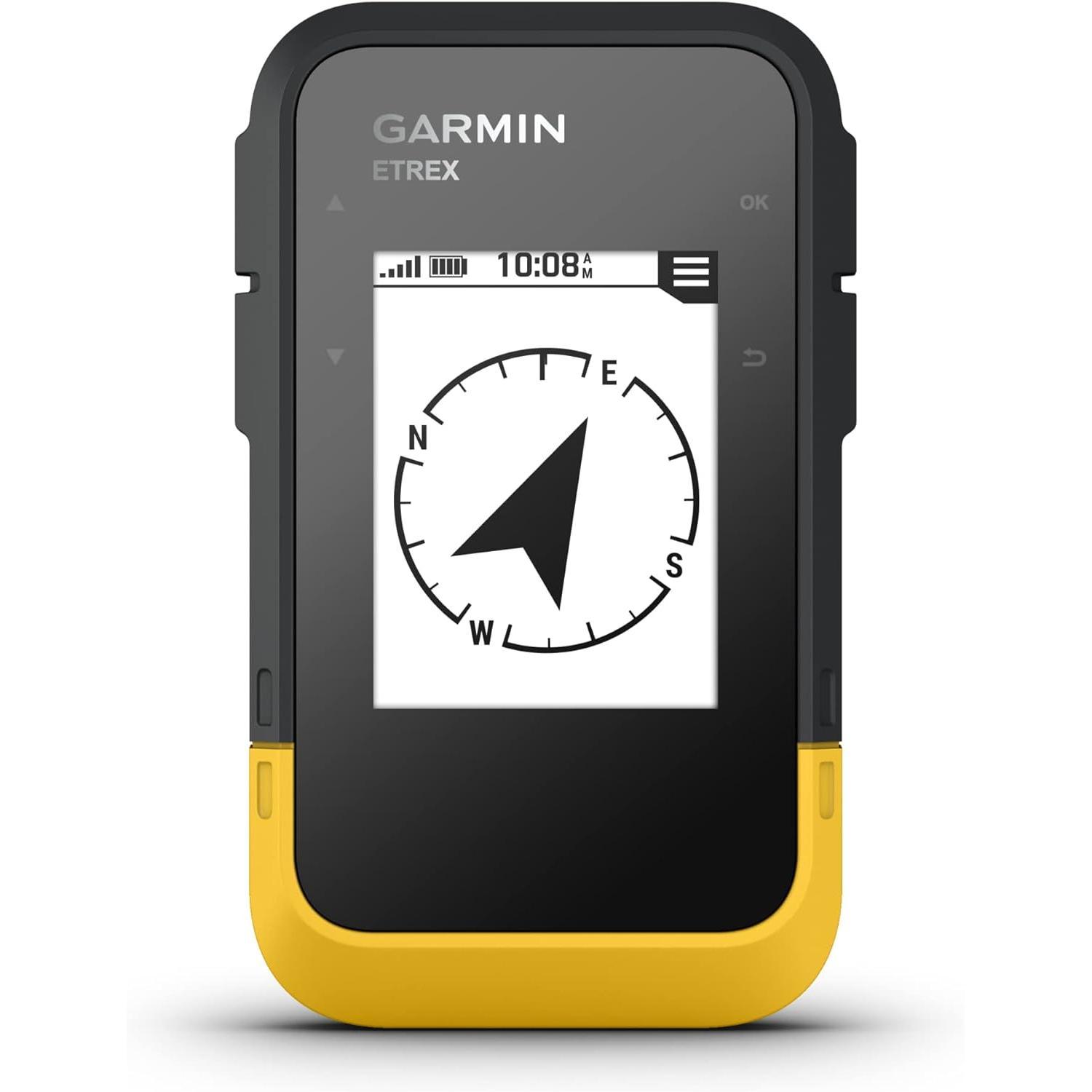
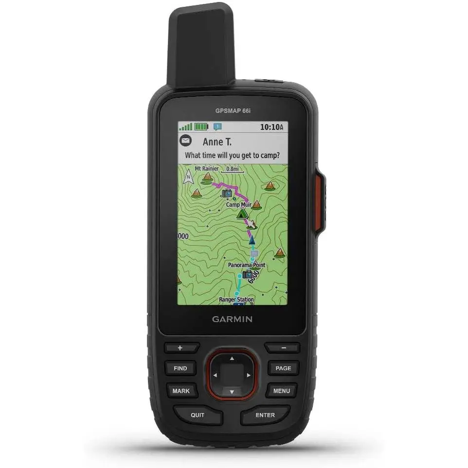
Ready. Set. Hike. With the eTrex® SE GPS handheld navigator, you’ll get battery life that lasts up to 168 hours with 2 AA batteries (not included). You’ll view waypoints, track your location and find your way back to favorite spots on the 2.2” high-resolution screen. You can pair it with the Garmin Explore™ app on your compatible smartphone for wireless software updates, Geocaching Live, wireless connectivity for cloud storage, Active Weather, smart notifications and more. It’s water-resistant (rated to IPX7) and offers multi-GNSS support to track in more challenging environments than GPS alone. With a digital compass that’s accurate even while standing still, it provides what you need to enjoy the outdoors more.
Price: C $174.99
as of April 27, 2024 4:24 pm
Price History
Statistics
| Current Price |
C $174.99 |
April 27, 2024 |
| Highest Price |
C $199.99 |
December 8, 2023 |
| Lowest Price |
C $174.00 |
April 24, 2024 |
Since November 23, 2023
Last price changes
| C $174.99 |
April 27, 2024 |
| C $174.00 |
April 24, 2024 |
| C $174.99 |
April 21, 2024 |
| C $178.77 |
April 16, 2024 |
| C $199.99 |
March 2, 2024 |
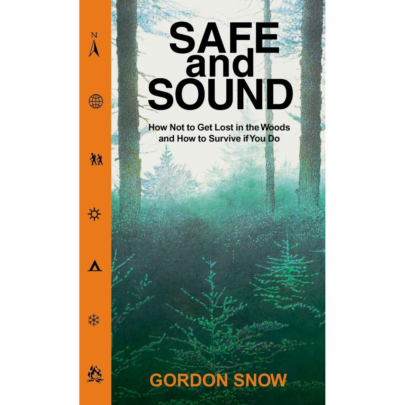
From the Inside Flap
Nobody means to get lost, but it can happen to just about anyone who ventures into the woods. In Safe and Sound, retired RCMP officer Gordon Snow tells how to guard yourself and your children against getting lost, and how young and old can emerge healthy and cheerful if, in spite of everything, they get lost anyway.
From the Back Cover
Nobody means to get lost, but it can happen to just about anyone who ventures into the woods. In Safe and Sound, retired RCMP officer Gordon Snow tells how to guard yourself and your children against getting lost, and how young and old can emerge healthy and cheerful if, in spite of everything, they get lost anyway.
About the Author
In 35 years as a Mountie, Gordon Snow participated in over 200 searches for lost people, supervising over 50 of them. In 1984, he became the RCMP ground search and rescue coordinator for New Brunswick, and, after retiring in 1992, he worked to train others in search and rescue techniques.
Price: C $8.96
as of April 27, 2024 10:26 pm
Price History
Statistics
| Current Price |
C $8.96 |
April 27, 2024 |
| Highest Price |
C $11.34 |
November 28, 2023 |
| Lowest Price |
C $8.96 |
April 10, 2024 |
Since November 23, 2023
Last price changes
| C $8.96 |
April 10, 2024 |
| C $9.95 |
March 19, 2024 |
| C $10.44 |
February 25, 2024 |
| C $10.45 |
February 23, 2024 |
| C $10.50 |
February 22, 2024 |
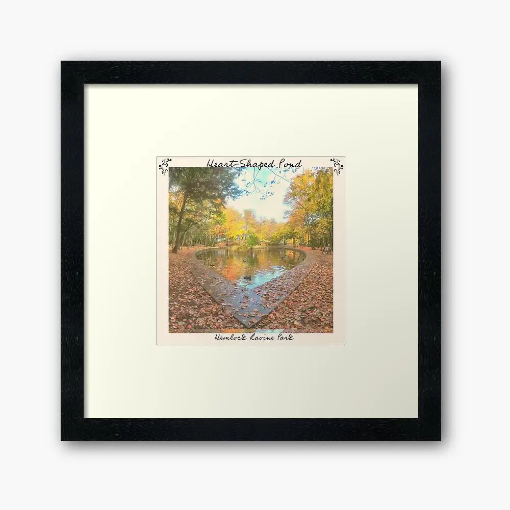
Iconic Nova Scotia
All of my original photography & unique designs are only available here, you won’t find them in stores or anywhere else. All photography was taken first-hand while exploring some of Nova Scotia’s best nature areas as I created free outdoor adventure guides for www.halifaxtrails.ca. Through the years I’ve built a sizeable following on Instagram & elsewhere as I’ve helped people to discover some of our province’s best hidden gems. All purchases help me to keep my maps, guides & virtual tours as a free resource for everyone.
Makes A Great Gift!