1 download limit per item. Licensed for non-commercial, single-use. Re-sale or re-distribution of any kind is prohibited. Intended for personal use on a single device, for additional devices and users, download additional files as needed. Copyright to this file is not transferred to the purchaser and is retained by the licensee.
Halifax Trails makes no warranty, representation or guaranty as to the content, sequence, accuracy or completeness of any of the database information provided herein. The user should not solely rely on the data provided herein. Map information is believed to be accurate but accuracy is not guaranteed. Any errors or omissions should be reported to info@halifaxtrails.ca. In no event will Halifax Trails be liable for any damages that might arise from the use of this mapping service or the information it contains. If you understand and agree to these terms, continue to download.

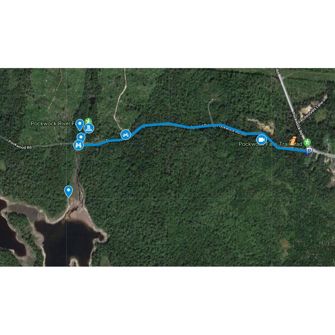
A Picturesque waterfall in Hammonds Plains, a short drive from downtown Halifax. Part of the Pockwock watershed which supplies much of the city of Halifax with its drinking water. Part of a large protected wilderness reserve.

GPS Maps: Parks, Trails & Wilderness Areas Near Halifax, Nova Scotia
- The Bluff Wilderness Trail – Hiking trails, points of interest, ‘leave no trace’ campsites, access points & portage routes.
- Blue Mountain Trail – Hiking trail & points of interest.
- Crowbar Lake Trails – Hiking trails & points of interest.
- Crystal Crescent Provincial Park Trails – Hiking trails, beaches & points of interest.
- Duncan’s Cove Hiking Trails – Hiking trails, access points, points of interest & Chebucto Head lighthouse.
- Victoria Park Trails (Truro) – Trails, access points, parking spots, points of interest, cross-country skiing & mountain biking locations.
- Kearney Lake Hiking Trails & Blue Mountain – Birch Cove Lakes Paddling Loop – Hiking trails, access points, points of interest, paddling route & portages. Susies Lake, Charlies Lake, Hobsons Lake, Fox Lake, Ash Lake & More.
- Kejimkujik National Park – Campsites, trails, points of interest, portages & paddling routes.
- Long Lake Provincial Park & Old St. Margaret’s Bay Road Walking Guide – Trails, paddling info, swim course & points of interest.
- McIntosh Run Singletrack Trails (Purcells Cove Backlands) – Singletrack mountain bike trail system and points of interest with 360° Views.
- McNabs Island Provincial Park – Hiking trails & points of interest.
- Musquodoboit River Paddling – Paddling routes, access points, campsites & parking spots.
- Nine Mile River Trails – Trails, points of interest & distance markers.
- Pockwock Falls – Trail, points of interest & parking.
- Polly’s Cove Hiking Trails – Trails, points of interest & parking spots.
- Purcell’s Cove Backlands – Parking, points of interest & trails including: McIntosh Run Singletrack Trails, Shaw Wilderness Park (Colpitt & Williams Lake), Kings Quarry, Conservation Lands & Pine Islands paddling loop.
- Rum Runner’s Trail – Chain Of Lakes Trail, BLT Trail, St. Margaret’s Bay Trail, Aspotogan Trail, Chester Connector, Castle Rock Hiking Trail, Dynamite Trail & Bay-To-Bay Trail. With points of interest, parking spots, access points, beaches & campgrounds.
- St. Mary’s River Paddling – North, West & East Branch paddling routes. Access points, salmon pools, points of interest & campsites.
- Taylor Head Provincial Park – Trails, points of interest, parking & beaches.
1 download limit. Licensed for non-commercial, single-use. Re-sale or re-distribution of any kind is prohibited. Intended for personal use on a single device, for additional devices and users, download additional files as needed. Copyright to this file is not transferred to the purchaser and is retained by the licensee.
Halifax Trails makes no warranty, representation, or guarantee as to the content, sequence, accuracy or completeness of any of the database information provided herein. The user should not solely rely on the data provided herein. Map information is believed to be accurate but accuracy is not guaranteed. Any errors or omissions should be reported to info@halifaxtrails.ca. In no event will Halifax Trails be liable for any damages that might arise from the use of this mapping service or the information it contains. If you understand and agree to these terms, continue to download.