


Description
|
|
|
|
|---|---|---|
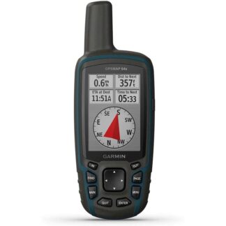
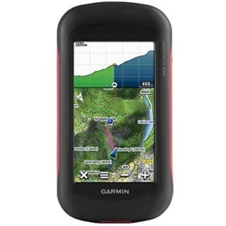
Find FunMontana supports paperless geocaching GPX files for straight-to-device uploading of geocaches from Geocaching.com. No more manually entering coordinates and paper print outs, Montana stores and displays key information, including location, terrain, difficulty, hints and descriptions. The track manager feature helps organize and navigate through waypoints/routes/ and track logs (easily start/stop recording tracklogs). |
Keep Your FixWith its high-sensitivity GPS and GLONASS reception, WAAS-enabled receiver and HotFix satellite prediction, Montana locates your position quickly and precisely and maintains it. Whether you’re in deep woods or just near tall buildings and trees, count on Montana to help you find your way when you need it most. |
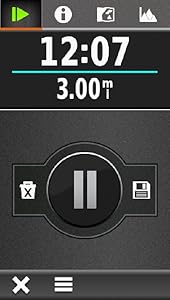
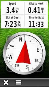
Enjoy the ViewMontana has a vast 4-inch, sunlight-readable touchscreen display, giving you vivid colors and high-resolution images. Its easy-to-use touchscreen means you’ll spend more time enjoying the outdoors and less time searching for information. |


Reviews
There are no reviews yet.